1
/
of
2
Victoria Cooper Antique Prints
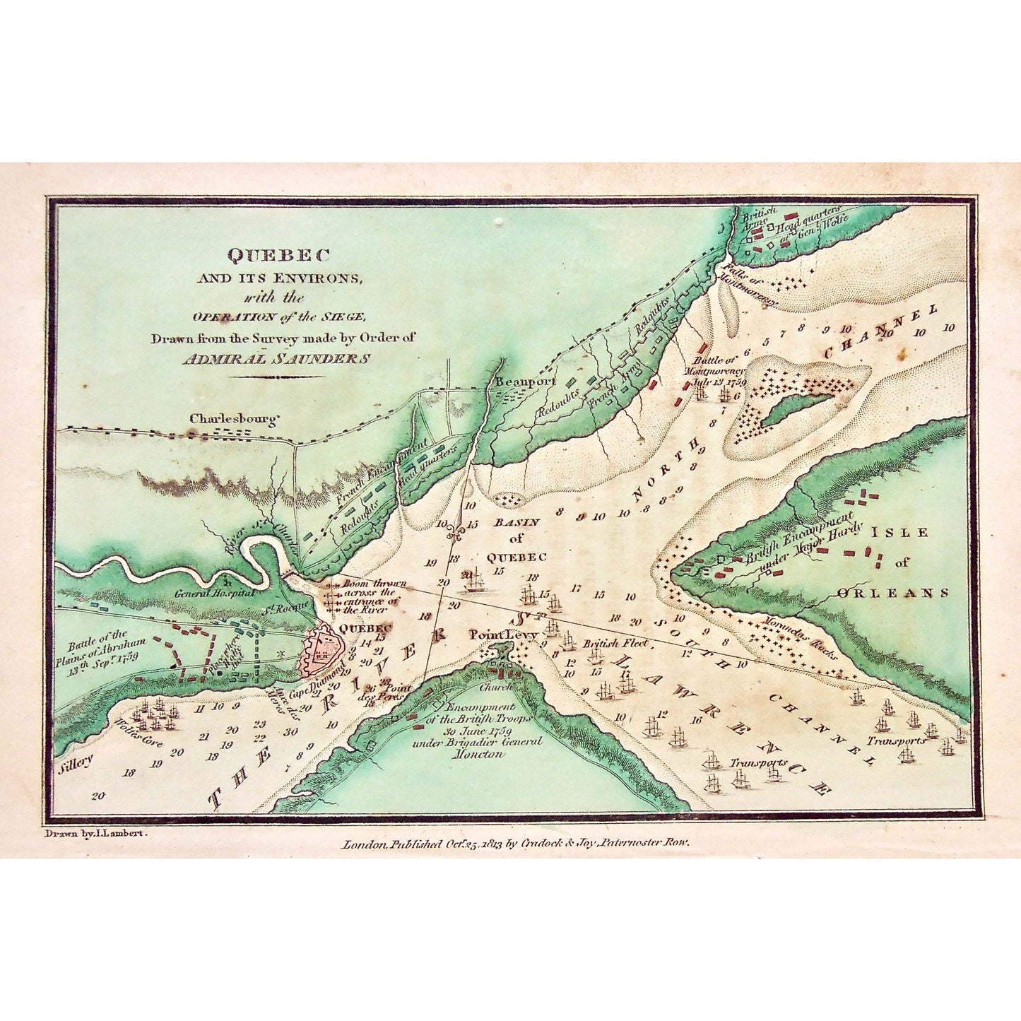
Quebec and its environs, with the Operation of the Siege. Drawn from the Survey made by Order of Admiral Saunders. (S3-70)
Quebec and its environs, with the Operation of the Siege. Drawn from the Survey made by Order of Admiral Saunders. (S3-70)
Regular price
$150.00 USD
Regular price
Sale price
$150.00 USD
Unit price
/
per
Couldn't load pickup availability
Quebec and its environs, with the Operation of the Siege. Drawn from the Survey made by Order of Admiral Saunders.
Lower Left: Drawn by I. Lambert. Lower Center: London, Published Oct. 25, 1803 by Cradock & Joy, Paternoster Row.
Publisher: Cradock & Joy
Place of Publication: Paternoster Row, London
Date: October 25th, 1803
Artist: I. Lambert
Paper Dimensions: 5 5/8 x 8 3/8 inches.
Medium: Copper engraving
Language: English
Coloured: Coloured (mostly green)
Condition: The map is in great condition with some wear around the edges, including the tear through the bottom of the paper, which can be seen.
Keywords: Quebec, Environs, Operation of the Siege, Siege, Operation, Admiral Saunders, Charlesbourg, Battle of the Plains of Abraham, Sept. 13, 1759, General Hospital, Sillery, River St. Lawrence, Basin of Quebec, Isle of Orleans, Isle d'Orleans, North Channel, Point Levy, Encampment of the British Troops, Encampment, British Troops, Place where Wolfe died, Wolfe, General Wolfe, Ance des Meres, Cape Diamond, St. Roque, River St. Charles, St. Charles River, French Encampment, Point des Peres, French Army, Redoubts, Beauport, Head Quarters, British Army Headquarters, Battle of Montmorency, July 13, Falls of Montmorency, Montmorency Falls, Headquarters of General Wolfe, General Wolfe's Headquarters, Transports, Brigadier General Moncton, Map, Maps, Mapping, Chart, Charts, Charting, Antique, Antique Map, Antique Print, Original maps, Vintage, Rare, Rare Maps, Battles,
Price: US$150
Identification Number: S3-70
Share