1
/
of
1
Victoria Cooper Antique Prints
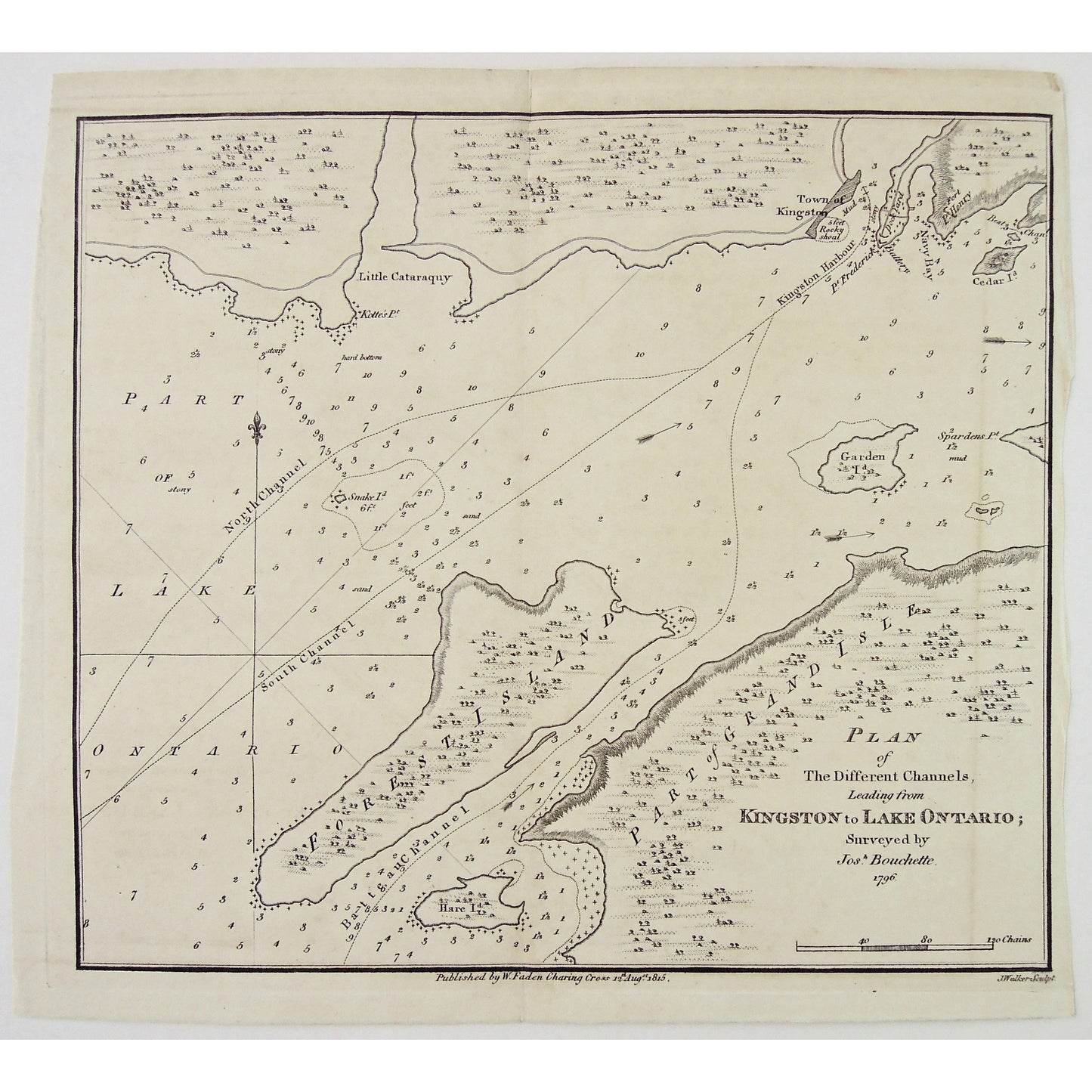
Plan of The Different Channels, Leading from Kingston to Lake Ontario; Surveyed by Josh. Bouchette. 1796. (S3-29a)
Plan of The Different Channels, Leading from Kingston to Lake Ontario; Surveyed by Josh. Bouchette. 1796. (S3-29a)
Regular price
$225.00 USD
Regular price
Sale price
$225.00 USD
Unit price
/
per
Couldn't load pickup availability
Plan of The Different Channels, Leading from Kingston to Lake Ontario; Surveyed by Josh. Bouchette. 1796.
Lower Center: Published by W.Faden Charing Cross 12th Augst 1815. Lower Right: J.Walker Sculpt.
Author: Joseph Bouchette (1774-1841)
Source / Publication: Topographical Description of the Province of Lower Canada; with remarks upon Upper Canada and on the relative connexion of both provinces with the United States of America.
Publisher: William Faden
Place of Publication: Charing Cross
Date: August 12th, 1815
Date (Depicted): 1796
Artist: Joseph Bouchette (1774-1841)
Engraver: J. Walker
Paper Dimensions: 9 1/2 x 10 1/2 inches.
Platemark Dimensions: 9 x 10 1/4 inches.
Medium: Engraving
Language: English
Coloured: Black and White
Condition: The print is in great condition with a crease line down the center and a faint brown line down the right side. The print has also been cropped within the platemark.
Keywords: Plan, Different Channels, Channels, Leading from Kingston to Lake Ontario, Kingston, Lake Ontario, Little Cataraquy, Snake Island, North Channel, South Channel, Forest Island, Batteau Channel, Hare Island, Spardens Island, Garden Island, Kingston Harbour, Cedar Island, Navy Bay, Town of Kingston, Kolte's Point,
Price: US$225
Identification Number: S3-29a
Share