1
/
of
2
Victoria Cooper Antique Prints
Map of the City of Quebec. (S3-76)
Map of the City of Quebec. (S3-76)
Regular price
$120.00 USD
Regular price
Sale price
$120.00 USD
Unit price
/
per
Couldn't load pickup availability
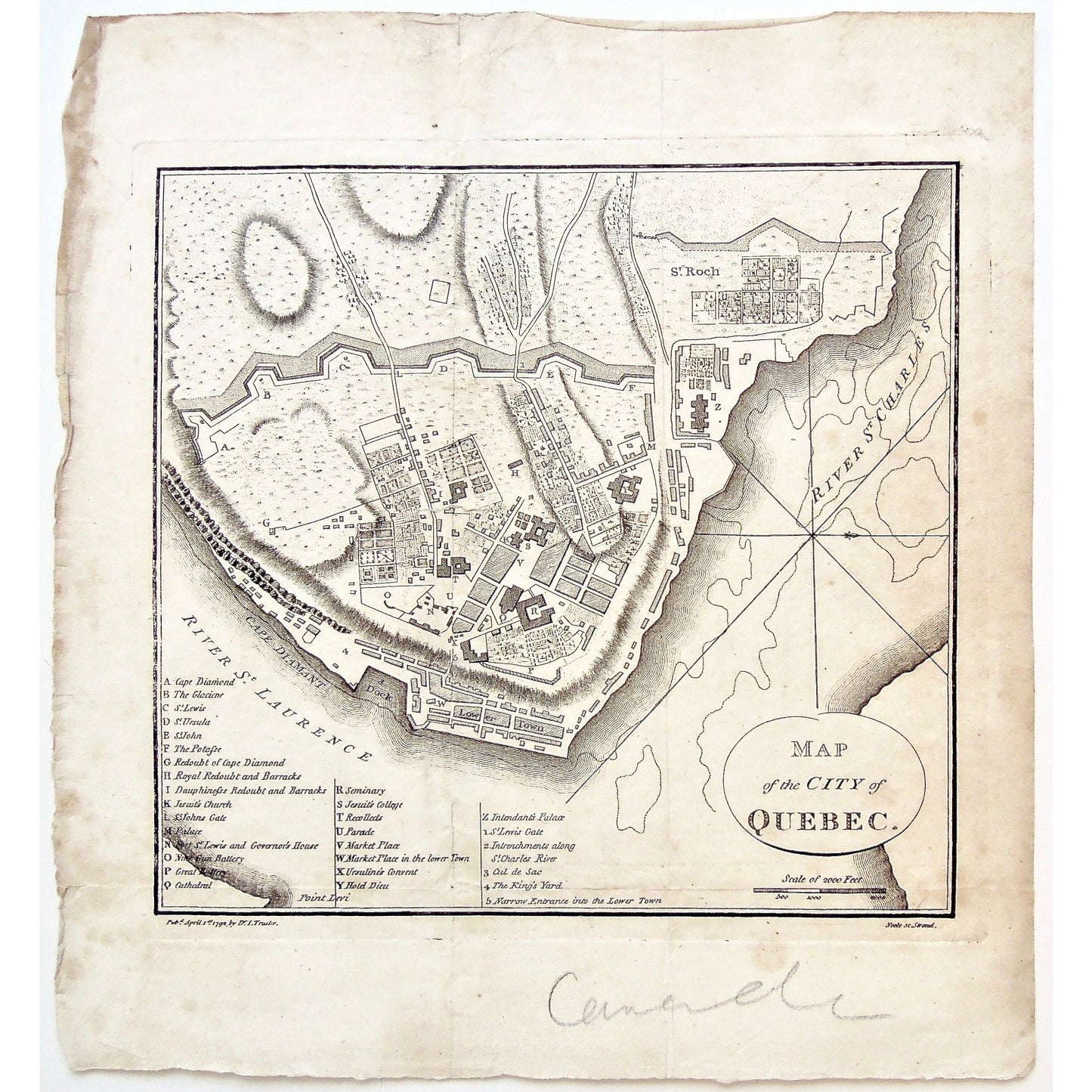
Map of the City of Quebec.
Lower Left: Pubd. April 1st 1792 by Dr. I. Trusler. Lower Right: Neele sc Strand.
Publisher: I. Trusler
Place of Publication: Strand
Date: April 1st, 1792
Engraver: Neele
Paper Dimensions: 10 3/4 x 10 inches.
Platemark Dimensions: 8 1/8 x 8 3/4 inches.
Medium: Copper Engraving
Language: English
Coloured: Black and white
Condition: The map is in good condition with some foxing and wear around the edges, including the word 'Canada' written in pencil (which we assume would erase rather easily), as can be seen.
Keywords: Map, Map of the City of Quebec, Map of Quebec City, Quebec City, St. Charles River, St. Roch, Lower town, Cape Diamant, Cape Diamond, Glaciene, St. Lewis, St. Ursula, St. John Potasse, Redoubt of Cape Diamond, Royal Redoubt, Royal Barracks, Barracks, Dauphiness' Redoubt, Dauphiness, Jesuits Church, Palace, St. John's Gate, Governor's House, Fort St. Lewis, Nine Gun battery, Great Battery, Cathedral, Seminary, Jesuit's College, Recollects, Parade, Market Place, Ursuline's Convent, Hotel Dieu, Intendant's Palace, St. Lewis Gate, King's Yard, Maps, Mapping, Chart, Charts, Charting,
Price: US$120
Identification Number: S3-76
Share