1
/
of
2
Victoria Cooper Antique Prints
Chart of Necker Island in 23'.34' of Latitude N. & 166'.52 of Longitude W. of Paris and of the Basses des Frégates Francaises or French Frigates Shoal, in 23'.45' of Latitude N. & 168'.10' of Longitude. Discovered in November 1786. (S3-88)
Chart of Necker Island in 23'.34' of Latitude N. & 166'.52 of Longitude W. of Paris and of the Basses des Frégates Francaises or French Frigates Shoal, in 23'.45' of Latitude N. & 168'.10' of Longitude. Discovered in November 1786. (S3-88)
Regular price
$325.00 USD
Regular price
Sale price
$325.00 USD
Unit price
/
per
Couldn't load pickup availability
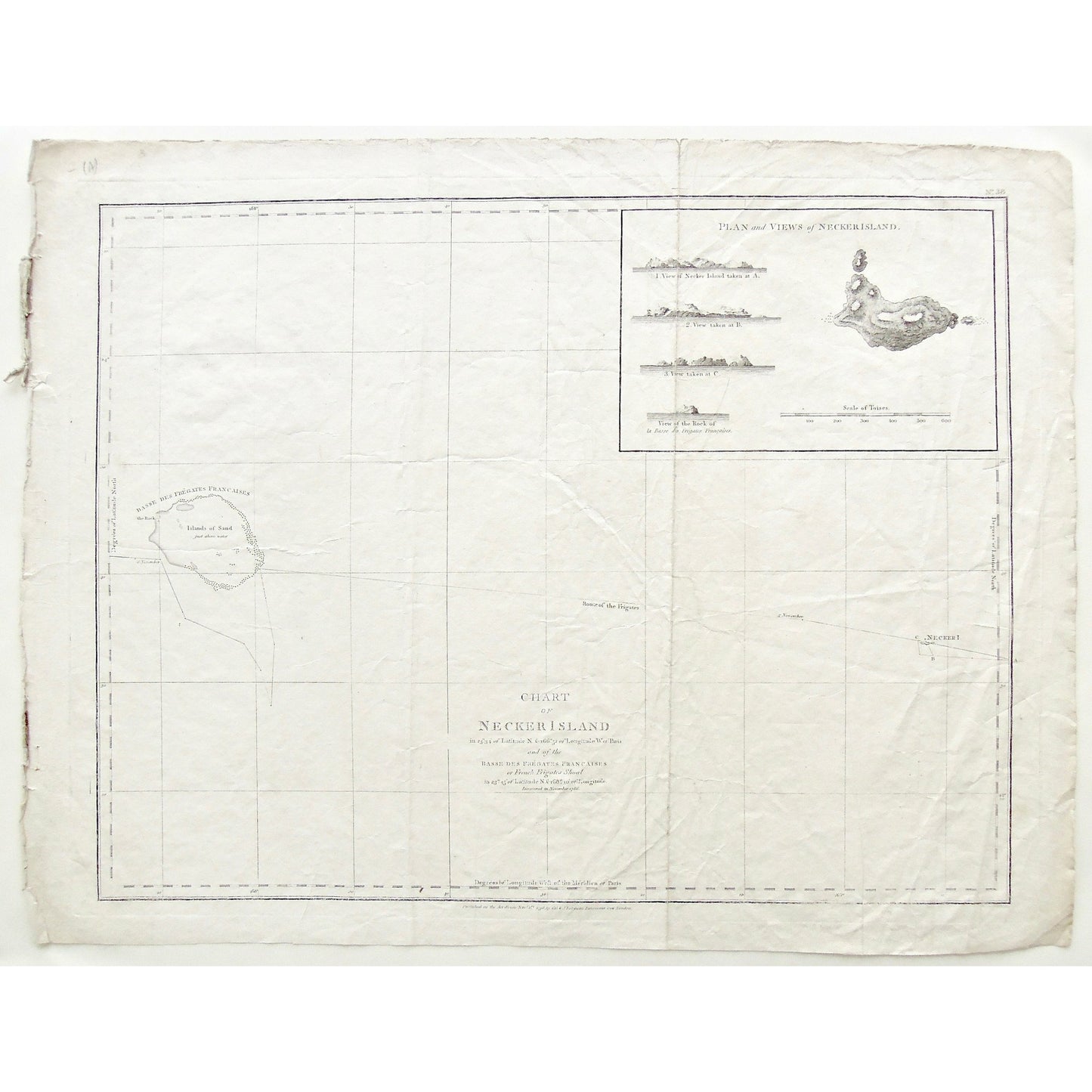
Chart of Necker Island in 23'.34' of Latitude N. & 166'.52 of Longitude W. of Paris and of the Basses des Frégates Francaises or French Frigates Shoal, in 23'.45' of Latitude N. & 168'.10' of Longitude. Discovered in November 1786.
Upper Right: No. 38. Lower Center: Published as the Act directs Novr. 1st, 1798 by G. G. & J. Robinson, Paternoster Row, London.
Author: La Pérouse, Jean-François de Galaup, comte de, (1741-1788)
Source / Publication: Charts And Plates To La Perouse's Voyage. Published as the Act directs Novr. 1st 1803
Publisher: G.G. & J. Robinson
Place of Publication: Paternoster Row, London
Date: November 1st, 1798
Date (Depicted): November, 1786
Plate Number: 38
Artist: La Pérouse, Jean-François de Galaup, comte de, (1741-1788)
Paper Dimensions: 17 1/8 x 22 inches.
Platemark Dimensions: 15 3/4 x 20 3/8 inches.
Coordinates: 23'.34' of Latitude N. & 166'.52 of Longitude W. of Paris - and - 23'.45' of Latitude N. & 168'.10' of Longitude
Medium: Copper engraving
Language: English
Coloured: Black and white
Condition: The print is in great condition with minimal wear around the edges, and a couple of large crease lines down the print, where there is more wear, as can be seen.
Keywords: Chart, Charting, Charts, Map, Mapping, Maps, Mapmaking, Chart of Necker Island, Necker Island, Basse des Frégates Francaises, French Frigates, Plan of Necker Island, Views of Necker Island, Views, Plan, Scale of Toises, Route of the Frigates, Route, Frégates Françaises, Islands of Sand, La Perousse, G. G. & J. Robinson, Paternoster Row, London, November 1786, 1786, Shoal, British Virgin Islands, BVI, B.V.I., Caribbean, Caribbean Island, Island, Islands,
Price: US$325
Identification Number: S3-88
Share