1
/
of
2
Victoria Cooper Antique Prints
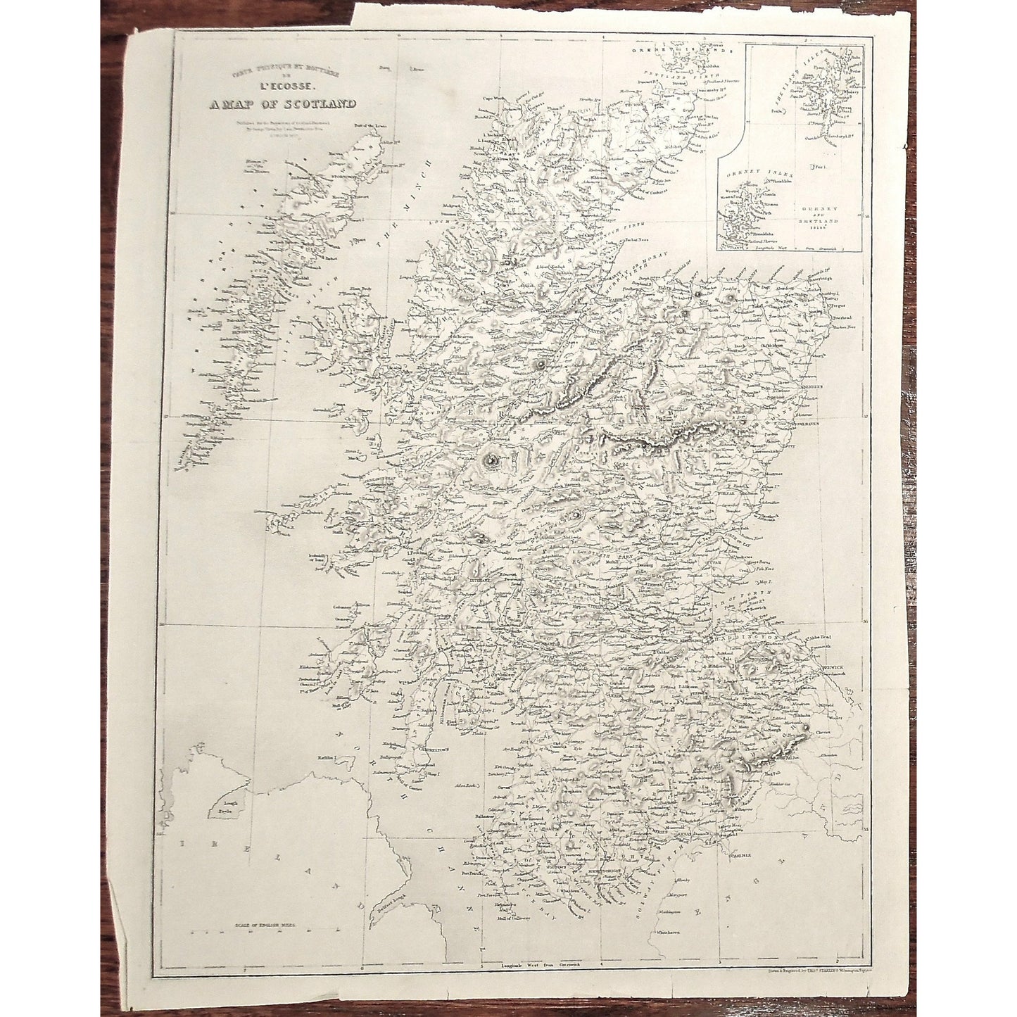
Carte physique et routière de l'Écosse. A Map of Scotland. Published for the Proprietors of Scotland Illustrated. By George Virtue, Ivy Lane, Paternoster Row. London. 1837. (S3-36)
Carte physique et routière de l'Écosse. A Map of Scotland. Published for the Proprietors of Scotland Illustrated. By George Virtue, Ivy Lane, Paternoster Row. London. 1837. (S3-36)
Regular price
$225.00 USD
Regular price
Sale price
$225.00 USD
Unit price
/
per
Couldn't load pickup availability
Carte physique et routière de l'Écosse. A Map of Scotland. Published for the Proprietors of Scotland Illustrated. By George Virtue, Ivy Lane, Paternoster Row. London. 1837.
Inset: Orkney and Shetland Isles. Lower Right: Drawn & Engraved by Thos. Starling, Wilmington Square.
Source / Publication: Scotland Illustrated.
Publisher: George Virtue
Place of Publication: Ivy Lane, Paternoster Row
Date: 1837
Engraver: Tomas Starling (Wilmington Square)
Paper Dimensions: 17 1/8 x 13 1/2 inches.
Medium: Copper engraving
Language: English and French
Coloured: Black and White
Condition: The print is in ok condition with wear around the edges, a tear into the top right corner of the print and a piece detached on the bottom right corner of the print, as can be seen.
Keywords: L'Ecosse, Scotland, Map, Scottish, Carte, Minch, Shetland Isles, Shetland Islands, Inverness, Aberdeen, Ross, Skye, Argyle, Ayre, North Channel, Scottish,
Price: US$225
Identification Number: S3-36
Share