1
/
of
2
Victoria Cooper Antique Prints
An Accurate Map of England and Wales with The Principal Roads from the best Authorities. (S3-52)
An Accurate Map of England and Wales with The Principal Roads from the best Authorities. (S3-52)
Regular price
$220.00 USD
Regular price
Sale price
$220.00 USD
Unit price
/
per
Couldn't load pickup availability
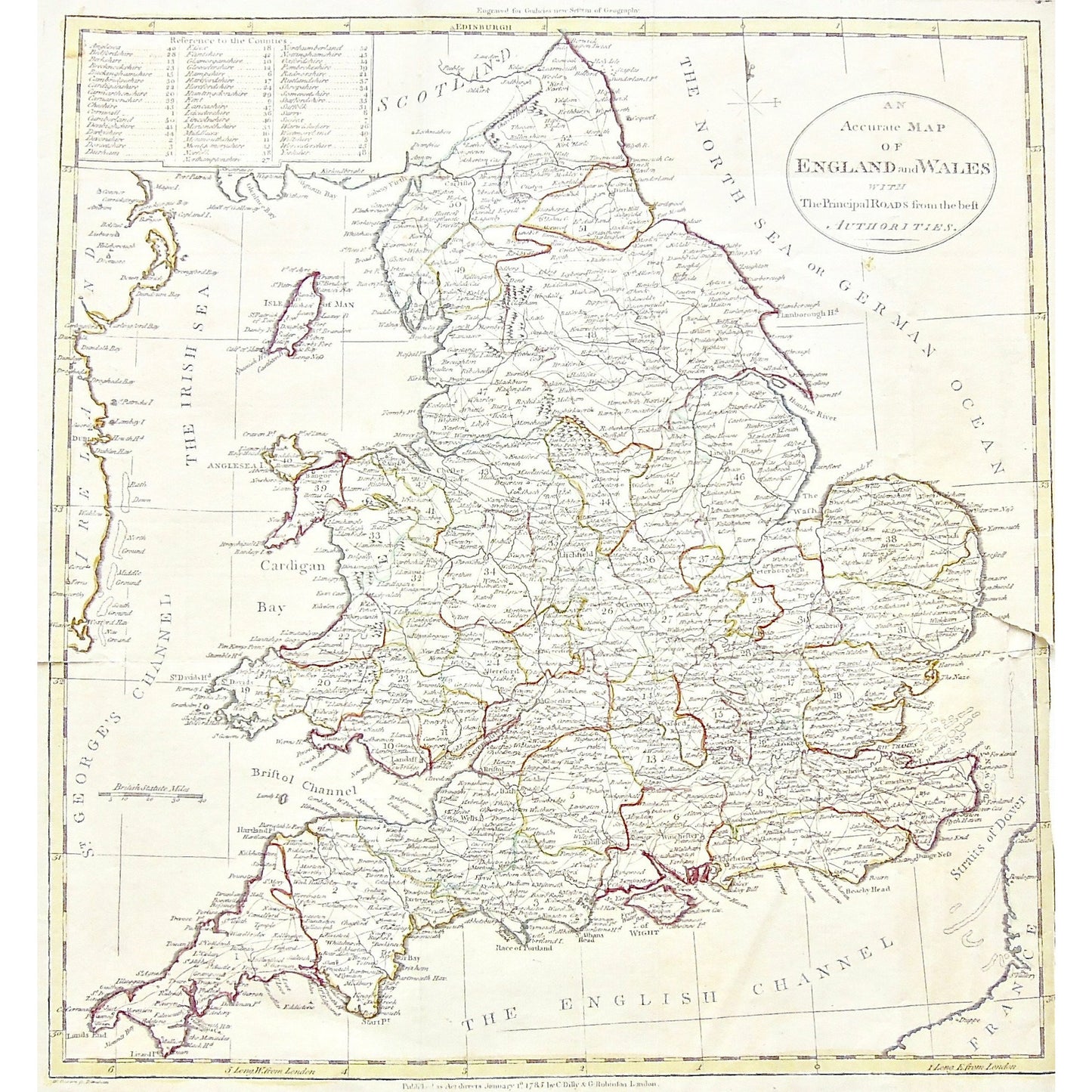
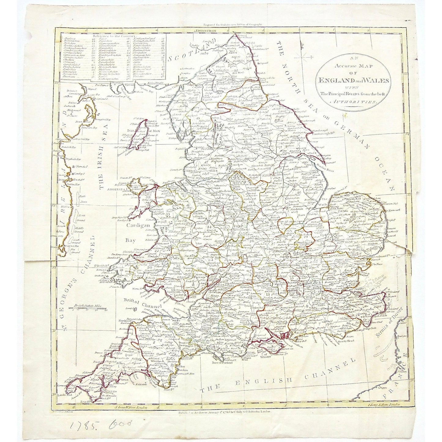
An Accurate Map of England and Wales with The Principal Roads from the best Authorities.
Upper Center: Engraved for Guthrie's New System of Geography. Lower Center: Published as the Act directs January 1st 1785, by C. Dilly & G. Robinson London.
Source / Publication: Guthrie's New System of Geography
Publisher: C. Dilly & G. Robinson
Place of Publication: London
Date: January 1st, 1785
Paper Dimensions: 15 1/2 x 14 inches.
Platemark Dimensions: 14 1/8 x 13 1/4 inches.
Medium: Copperplate engraving
Language: English
Coloured: Coloured outline
Condition: The print is in good condition; however, there is a clean tear into the left side of the print, as well as a larger tear into the right side of the print, about 2 1/2 inches in, as can barely be seen.
Keywords: Accurate Map of England and Wales, Accurate, Map, Maps, Mapping, Chart, Charts, Charting, England, Wales, Scotland, North Sea, German Ocean, British Sea, St. George's Channel, Cardigan Bay, Bristol Channel, English Channel, Straits of Dover, Ireland, France, Isle of Man, Irish Sea, Isle of Wight, Strat point, Humber River, The Wash, Anglesea Island, Anglesea, 1785, C. Dilly, Dilly, G. Robinson, Robinson, Guthrie's New System of Geography, Guthrie, Guthrie's, New System of Geography, Copperplate, Copper, Engraving, Antique print, Antique Map, Antique Maps, Vintage Maps, Original Maps, Wall Art, Wall decor, Design, Coloured outline,
Price: US$220
Identification Number: S3-52
Share