1
/
of
2
Victoria Cooper Antique Prints
A New Map of the Province of Quebec in North America. Drawn from the best Authorities: By Thos. Kitchin Geogr. (S3-47b)
A New Map of the Province of Quebec in North America. Drawn from the best Authorities: By Thos. Kitchin Geogr. (S3-47b)
Regular price
$130.00 USD
Regular price
Sale price
$130.00 USD
Unit price
/
per
Couldn't load pickup availability
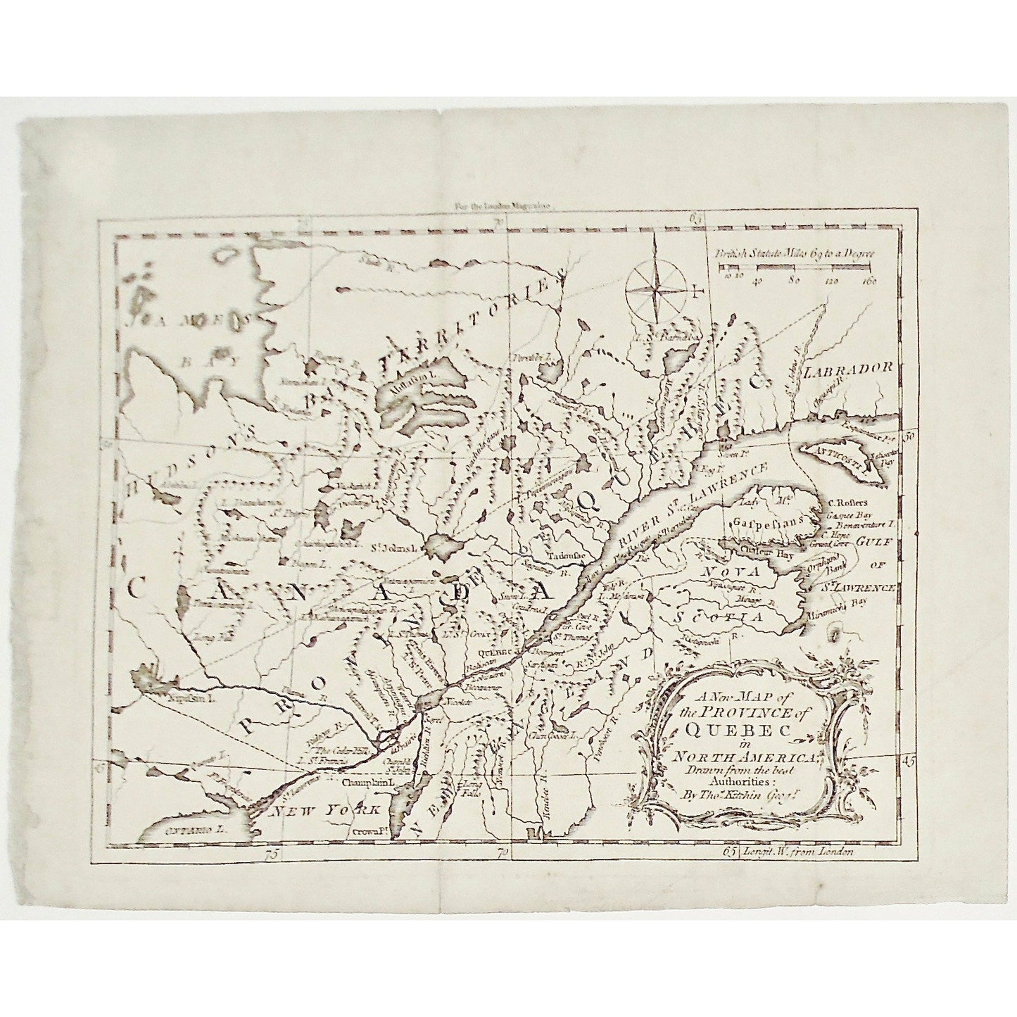
A New Map of the Province of Quebec in North America. Drawn from the best Authorities: By Thos. Kitchin Geogr.
Upper Center: For the London Magazine.
Source / Publication: London Magazine
Place of Publication: London
Date: October, 1764
Volume: 33
Page Number: 496
Artist: Thomas Kitchin
Paper Dimensions: approximately 8 x 10 1/4 inches.
Platemark Dimensions: 7 x 9 inches.
Medium: Copperplate engraving
Language: English
Coloured: Black and white
Condition: The print is in good condition with some crease marks, as well as some wear around the edges, particularly on the top left of the print, as can be seen.
References: Phillips, Maps:729; WLCL 2:135; BMPM 11/956; Kershaw, K. Early printed maps of Canada, vol. 4, no. 1003
Keywords: James Bay, James, Bay, Lake, Canada, Hudson's Bay, Territory, Territories, Province of Quebec, New York, Labrador, New England, Nova Scotia, Gulf of St. Lawrence, Gulf, St. Lawrence, River, Stude, Ruperts River, Nemiskau Lake, Nodaway, Mittasin Lake, Peretibi Lake, St. Barnaba, Bustard, Mamikouagane, St. Margaret, St. Johns, Betsianuite, Missipinak, Seven Islands, Egg Island, Anticosti, Esquimaux Point, Chousipi, Natisotec Bay, Papinmouagane, Ouichtilagane, Chesouematan, Naskatich, Gr. Discharge, Abitibis, Beauharnois, St. Peters Lake, Miskouaskane, Ouichigaubich, Begon, St. Johns Lake, Oumaniouctz, Temiscaming, Long Fall, Hare Island, Isles Basques, Lady Mountains, Tadoulac, Saquenay, Snow Lake, Coudres Island, Orleans Island, Natouagamion, Achoupekahigan, Kaouinagamich, St. Thomas, Trois Rivieres, St. Peters, Lac St. Croix, Baliscan, Nipissin Lake, Quento Lake, Fort Frontenac, Utatuas, Ridecay, Cedar Hills, Lac St. Francis, Waterie, Arpentigni, Assumption River, C. Rolfers, Gaspee Bay, Bonaventure Island, Cape Hope, Grand Cove, Orphan's Bank, Chaleur Bay, Gaspesians, Miramichi Bay, Ristigouche River, Nipissiguet River, Minage River, Bic, Wolf River, Mendousa, Ouel River, Gr. Cove, St. Thomas, Beaumont, Ristigouchi River, Penobscot, Kenebec, Chenbasec Lake, Nomscot River, Beamont, Satigan, Lobinieres, Becancour, Nicolete, Sorel, La Prairie, Chamblis, Crownt Point, Champlain lake, Lac Champlain, Kitchin, Thomas Kitchin, London Magazine, London, Mag., 1764, Map, Maps, Mapping, Chart, Charting,
Price: US$130
Identification Number: S3-47b
Share