1
/
of
2
Victoria Cooper Antique Prints
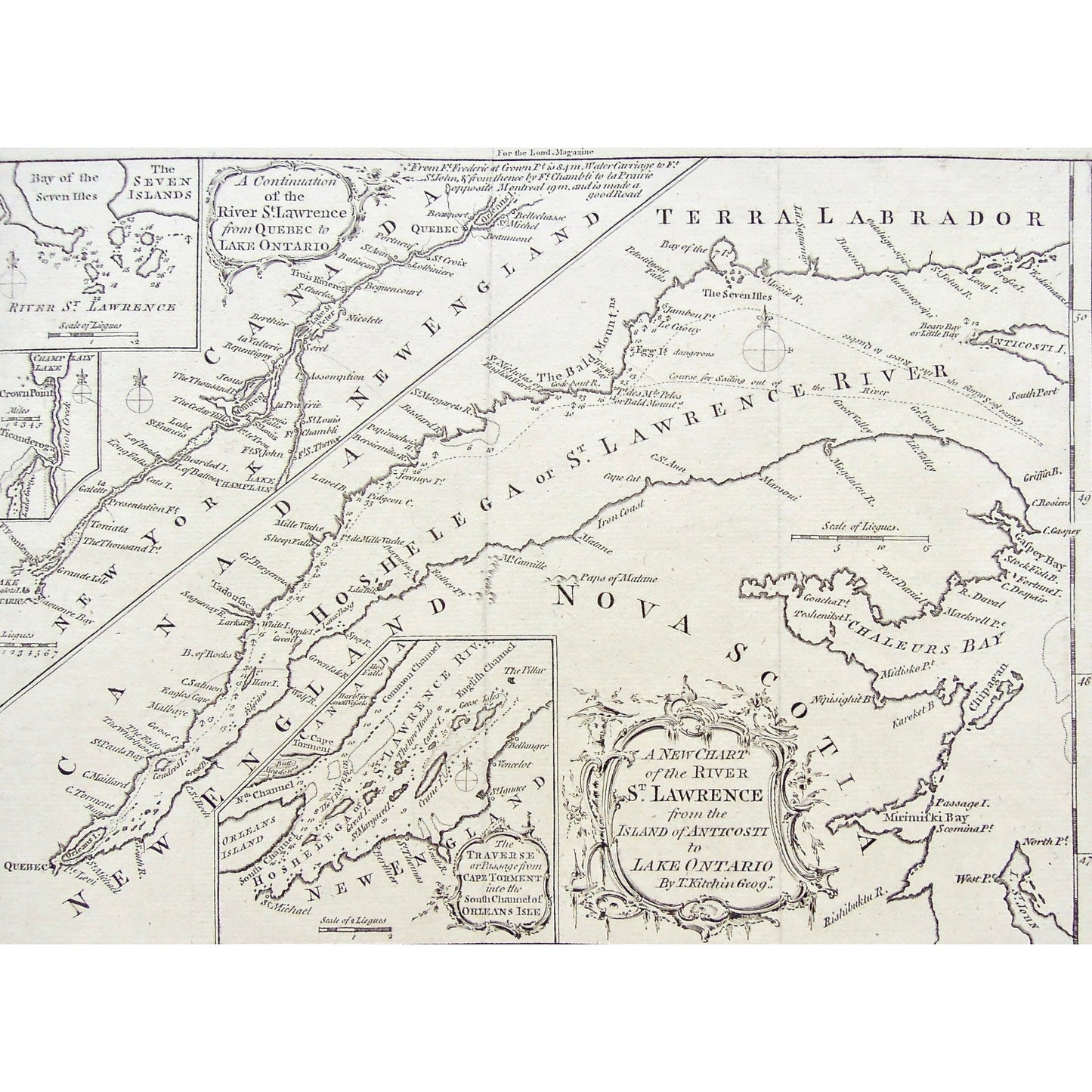
A New Chart of the River St. Lawrence from the Island of Anticosti to Lake Ontario. By Thos. Kitchin Geogr. (S3-49b)
A New Chart of the River St. Lawrence from the Island of Anticosti to Lake Ontario. By Thos. Kitchin Geogr. (S3-49b)
Regular price
$120.00 USD
Regular price
Sale price
$120.00 USD
Unit price
/
per
Couldn't load pickup availability
A New Chart of the River St. Lawrence from the Island of Anticosti to Lake Ontario. By Thos. Kitchin Geogr.
Upper Left: A Continuation of the River St. Lawrence from Quebec to Lake Ontario. Smaller Insets: within above inset: The Seven Islands. Lake Champlain. Lower Center: The Traverse or Passage from Cape Torment into the South Channel of Orleans Isle. Upper Center: For the Lond. Magazine.
Source / Publication: London Magazine
Place of Publication: London
Date: 1759
Artist: Thomas Kitchin
Paper Dimensions: 8 1/8 x 10 3/8 inches.
Platemark Dimensions: 7 3/8 x 10 1/8 inches.
Medium: Copperplate engraving
Language: English
Coloured: Black and white
Condition: The print is in great condition with a couple of faint, vertical crease marks; and the print has also been cropped very closely on the left side of the print, as can be seen.
Keywords: Terra Labrador, Labrador, River St. Lawrence, St. Lawrence River, Canada, New England, Nova Scotia, Hochelaga, Chart, River, Charting, Map, Maps, Bay of Seven Isles, Lake Ontario, New York, Chaleur Bay, Cape Torment, South Channel, Orleans Isle, Bald Mountains, Quebec, Canada, Anticosti, Island, Ticonderoga, Champlain, Crown Point, Lake champlain, Seven Isles, Trois Rivieres, Thomas Kitchin, Kitchin, 1759, London Magazine, London, Magazine, Mag., Charts, Mapping,
Price: US$120
Identification Number: S3-49b
Share