1
/
of
2
Victoria Cooper Antique Prints
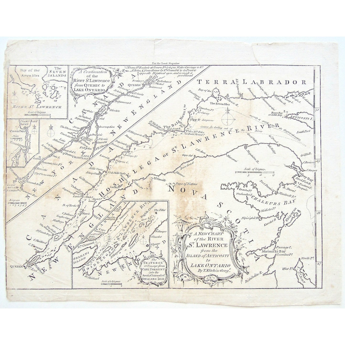
A New Chart of the River St. Lawrence from the Island of Anticosti to Lake Ontario. By Thos. Kitchin Geogr. (S3-49a)
A New Chart of the River St. Lawrence from the Island of Anticosti to Lake Ontario. By Thos. Kitchin Geogr. (S3-49a)
Regular price
$90.00 USD
Regular price
Sale price
$90.00 USD
Unit price
/
per
Couldn't load pickup availability
A New Chart of the River St. Lawrence from the Island of Anticosti to Lake Ontario. By Thos. Kitchin Geogr.
Upper Left: A Continuation of the River St. Lawrence from Quebec to Lake Ontario. Smaller Insets: within above inset: The Seven Islands. Lake Champlain. Lower Center: The Traverse or Passage from Cape Torment into the South Channel of Orleans Isle. Upper Center: For the Lond. Magazine.
Source / Publication: London Magazine
Place of Publication: London
Date: 1759
Artist: Thomas Kitchin
Paper Dimensions: 8 3/8 x 10 5/8 inches.
Platemark Dimensions: 7 3/8 x 10 1/4 inches.
Medium: Copperplate engraving
Language: English
Coloured: Black and white
Condition: The print is in good condition with some browning across it, as well as some wear around the edges, and a crease mark through the center, at the ends of which the paper is torn on either end about one inch in. There is also a small tear into the top right of the print, as can be seen.
Keywords: Terra Labrador, Labrador, River St. Lawrence, St. Lawrence River, Canada, New England, Nova Scotia, Hochelaga, Chart, River, Charting, Map, Maps, Bay of Seven Isles, Lake Ontario, New York, Chaleur Bay, Cape Torment, South Channel, Orleans Isle, Bald Mountains, Quebec, Canada, Anticosti, Island, Ticonderoga, Champlain, Crown Point, Lake champlain, Seven Isles, Trois Rivieres, Thomas Kitchin, Kitchin, 1759, London Magazine, London, Magazine, Mag., Map, Maps, Mapping, Chart, Charts, Charting, Copperplate, Engraving, Antique map, Antique Print,
Price: US$90
Identification Number: S3-49a
Share