Victoria Cooper Antique Prints
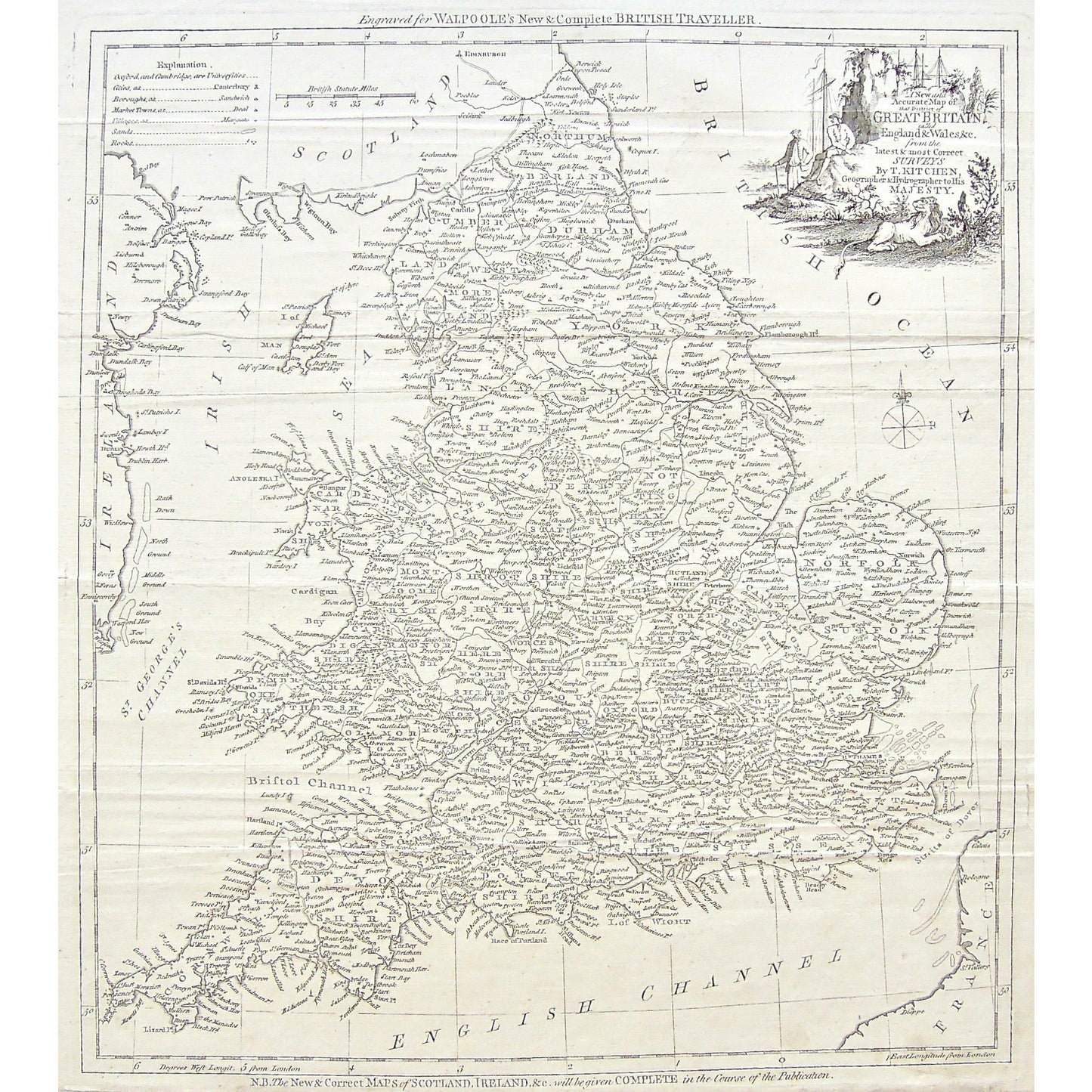
A New and Accurate Map of that District of Great Britain called England & Wales &c. from the latest & most Correct Surveys. By T Kitchen, Geographer & Hydrographer to His Majesty. (S3-P-50)
A New and Accurate Map of that District of Great Britain called England & Wales &c. from the latest & most Correct Surveys. By T Kitchen, Geographer & Hydrographer to His Majesty. (S3-P-50)
Couldn't load pickup availability
A New and Accurate Map of that District of Great Britain called England & Wales &c. from the latest & most Correct Surveys. By T Kitchen, Geographer & Hydrographer to His Majesty.
Upper Center: Engraved for Walpoole's New & Complete British Traveller. Lower Center: N.B. The New & Correct Maps of Scotland, Ireland, &c. will be given Complete in the Course of the Publication.
Source / Publication: New & Complete British Traveller
Publisher: Walpoole
Place of Publication: London
Date: 1784
Date (Depicted): 1757
Artist: Thomas Kitchin
Paper Dimensions: 16 1/8 x 14 5/8 inches.
Platemark Dimensions: 15 1/4 x 13 1/2 inches.
Medium: Copperplate engraving
Language: English
Coloured: Black and white
Condition: The print is in great condition except for the sides, where the print is worn and there are several clean tears into each of the sides of the print, as can barely be seen.
Keywords: Walpoole, Great Britain, England, Wales, Surveys, Thomas Kitchin, Kitchin, New & Complete British Traveller, British Traveller, British, Traveller, Geographer, Hydrographer, His Majesty, Scotland, British Ocean, Irish Sea, Ireland, St. George's Channel, Bristol Channel, English Channel, Straits of Dover, France, Map, Mapping, Maps, Chart, Charts, Charting, 1757, Copperplate, Copper, Engraving, Antique Map, Antique Maps, Antique Print, Antique prints, Wall map, Wall decor, art, history, Original, print, Antique, Vintage,
Price: US$350
Identification Number: S3-P-50
Share